Update, 4:50 p.m., Sept. 27:
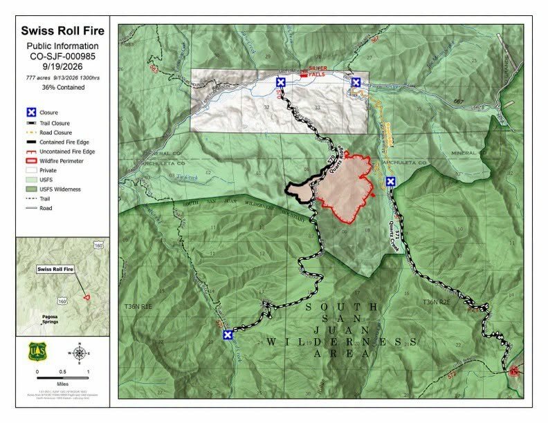
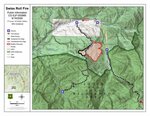
The Swiss Roll Fire is now 88% contained, following information gained from a Multi-Mission Aircraft (MMA) infrared flight on Saturday, September 26. The flight detected scattered areas of remaining heat within the interior of the fire, with no growth along the perimeter and significantly fewer heat detections than during the previous MMA flight approximately one week earlier. Based on this information and current conditions, fire managers were able to identify additional portions of the fire perimeter as contained. The remaining 12% of uncontained perimeter is on the northeast side of the fire, as can be seen on the included map.
At 5 p.m. today, Sunday, September 27, the Swiss Roll Fire will transition back to the Pagosa Ranger District as the Burning Mountain Wildland Fire Module completes its assignment. Local fire managers will continue to monitor conditions and determine any additional actions needed.
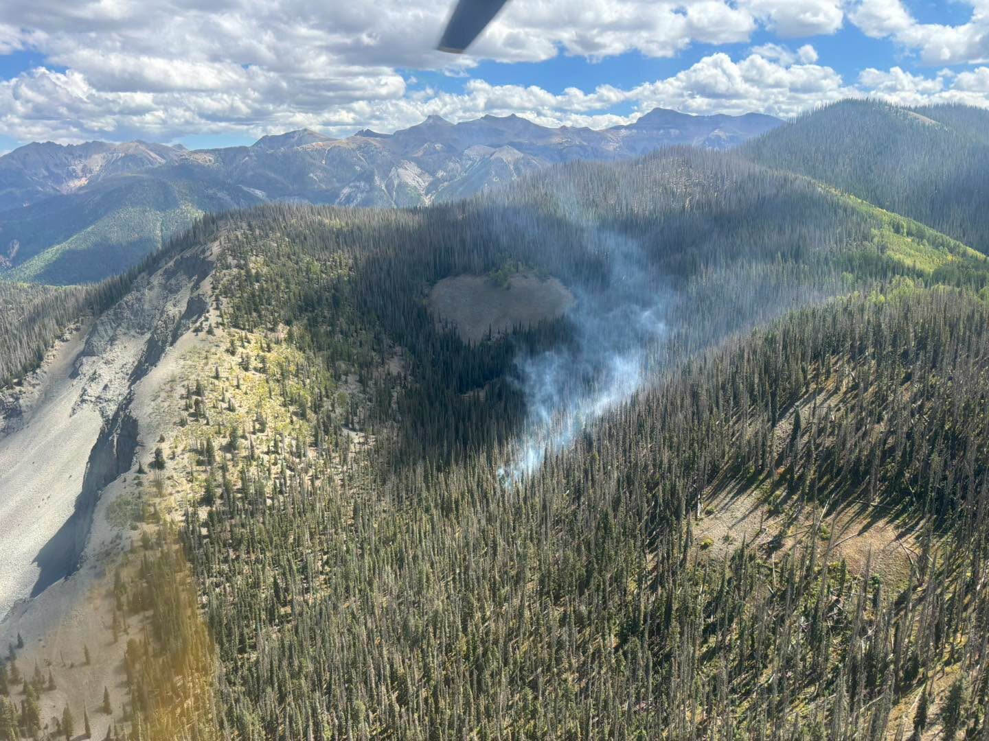
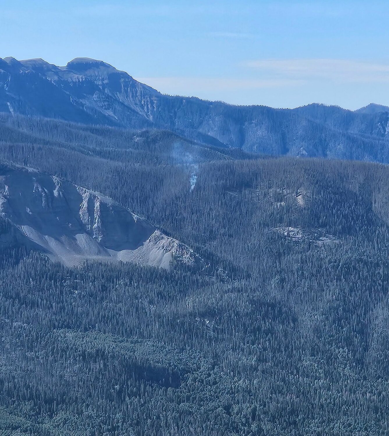
While current conditions and the seasonal weather outlook continue to look favorable, the Swiss Roll Fire is not out. Remaining heat is primarily associated with downed heavy timber and burning stumps, which can retain heat for an extended period. Significant perimeter growth would likely require an extended period of unseasonably warm and dry weather; however, residual heat may persist for weeks, and smoke could become visible again during warmer, drier conditions.
Additional moisture is expected to begin moving into the area this evening, with wetting rains possible over the next several days. A Flood Watch is in effect Monday through Wednesday (September 28-30), creating additional concerns for roadway conditions in and around the fire area.
As hunting season continues, we want to remind visitors that increased containment and reduced fire activity do not mean the burned area is free of hazards. Fire-weakened trees can fall without warning, burning stump holes and residual heat can cause serious injury, and recent rains have created additional hazards including muddy or damaged roads, flooding and rockfall. Fire personnel continue to inform hunters and other visitors in the area about these risks.
Road and trail closures remain in effect. Please continue to respect all posted closures and avoid traveling or recreating in and around the burned area whenever possible.
Fire information will continue to be shared through the San Juan National Forest Facebook page and InciWeb as conditions warrant.
Closure information: https://tinyurl.com/SwissRollClosure
InciWeb: https://inciweb.wildfire.gov/incident-information/cosjf-swiss-roll-fire
Update, 2:15 p.m., Sept. 22:
Tonight, Sept. 22, at 6 p.m., the Swiss Roll Fire will transition from a Type 4 to a Type 5 incident management organization. This transition reflects current fire conditions and the level of resources needed to manage the fire.
Road and trail closures remain in effect. Please continue to avoid the burned area and respect all posted closures.
Update, 5 p.m., Sept. 19:
As of Sept. 19, the Swiss Roll Fire is 36 percent contained. As shown on the included map, this containment is on the west and northwest portions of the fire, with all fire perimeter west of the Quartz Ridge Trail identified as contained.
Firefighters will continue to monitor the Swiss Roll Fire, and containment may be adjusted if conditions change.
Update, 11 a.m., Sept. 19:
Fire behavior remains minimal on the Swiss Roll Fire following several days of moisture. Today, conditions will allow firefighters to continue preparation work along Quartz Road, including cutting brush, removing fire-weakened dead trees and reducing ladder fuels. This work reduces available fuels if the fire becomes more active again while also supporting long-term stewardship of the area.
As a reminder, burned areas contain numerous hazards such as muddy, slick roads that may be damaged or washed out, fire-weakened trees that can fall without warning, and burning stump holes that can cause serious injury if stepped into. We strongly encourage the public to avoid the Swiss Roll Fire burn area and continue to respect all road and trail closures.
Update, 11:30 a.m., Sept. 16:
Yesterday, crews conducted prep work along Quartz Creek Road (NFSR 684), cutting brush, fire-weakened dead trees and removing ladder fuels while other resources monitored fire behavior and assessed values at risk.
Fire behavior was moderate due to the cooler temperatures throughout the day, with no observable growth in acreage.
Update, noon, Sept. 15:
Fire activity on the Swiss Roll Fire has moderated after receiving rainfall for multiple days. This week, rain showers are expected to keep fire behavior to a minimum. Crews will remain engaged in monitoring activities, especially after the wet period passes. There are also engines and additional overhead to support any potential needs. The fire is unlikely to completely go out until it receives snowfall. Due to turbulent flight conditions and cloud cover, no fixed wing aircraft will be able to fly over the fire to obtain current acreage or produce future maps.
Fire managers have been employing an indirect containment strategy for this fire since it was first detected on Aug. 20, using predetermined action points if/when the fire reaches certain locations. These fire lines may include roads and natural features (like rock outcroppings and Quartz Meadow). Fire crews cannot engage the Swiss Roll Fire directly across much of its footprint due to extremely high threat to safety from falling dead trees and lack of access in the case of a medical emergency. Falling trees are the number one cause of wildland firefighter fatalities. Additionally, the fire is not expected to threaten life or property due to its remote location and therefore does not justify putting firefighters at risk.
The remote, lightning-caused fire is located east of Pagosa Springs and U.S. 160, south of East Fork Road (CR 667) near Quartz Meadow. Following days of hot dry weather, the fire was driven by wind on Friday from roughly ten acres to 370 acres. On Saturday, the fire grew to 777 acres as outflow winds from passing thunderstorms pushed it farther south and east.
Road and trail closure: For the safety of firefighters and the public, the Pagosa Ranger District has implemented a road and trail closure in the vicinity of the Swiss Roll Fire. The closure restricts public access to all lands, roads, and trails within the described area (see map) including Quartz Meadows Road (NFSR 684), Quartz Creek Trail #571, and Quartz Ridge Trail #570 at the Quartz Ridge Trailhead near the Silver Falls Guard Station. The Quartz Creek Trail #570 (from the Sand Creek Trailhead) will remain open for approximately 4 1.2 miles until it turns east.
Violations of this closure order are punishable as a Class B misdemeanor by a fine of not more than $5,000 for individuals and $10,000 for organizations, or by imprisonment for not more than six months, or both.

For updated information on the Swiss Roll Fire, visit the Swiss Roll Fire Inciweb page, the San Juan National Forest Facebook page, or email the the incident public information team with specific questions at 2026.swissroll@firenet.gov.
Update, 11 a.m., Sept. 15:
Fire crews on the Swiss Roll Fire briefed this morning to assess conditions and strategies for engaging the fire in Quartz Meadow. Today the San Juan National Forest Columbine, Elk Creek and Burning Mountain Wildland Fire Modules are assessing Quartz Creek Road (NFSR 684) for prep that may be completed along the roadside to the southwest corner of Quartz Meadow. Building indirect handline in this area provides safer working conditions for firefighters on the ground compared to the steep terrain in dead timber higher up on the slope. There has been no change in the acreage or containment, and recent precipitation and cooler temperatures have reduced the fire's activity and more rain is expected throughout the week.
For the safety of firefighters and the public, the Pagosa Ranger District has implemented a road and trail closure in the vicinity of the Swiss Roll Fire. The closure restricts public access to all lands, roads, and trails within the described area (see map) including Quartz Meadows Road (NFSR 684), Quartz Creek Trail #571, and Quartz Ridge Trail #570 at the Quartz Ridge Trailhead near the Silver Falls Guard Station. The Quartz Creek Trail #570 (from the Sand Creek Trailhead) will remain open for approximately 4 1.2 miles until it turns east.
Update, 9:15 a.m., Sept. 14:
The wet weather has significantly reduced fire activity on the Swiss Roll Fire, east of Pagosa Springs. Rain is expected throughout the week, though fire crews continue to monitor the Swiss Roll and will engage the fire if needed. It is unlikely the rain will put the fire out, considering how dry the vegetation is, but it will greatly reduce the likelihood of the fire moving beyond its current footprint.
Update, 9 p.m., Sept. 13:
The fire was mapped today at 777 acres, and has received rainfall periodically today and this evening.
Update, 12:20 p.m., Sept. 13:
The San Juan National Forest Columbine Wildland Fire Module (WFM) inbriefed this morning to join Elk Creek WFM on the Swiss Roll Fire. The Columbine module is drone-equipped, which will improve situational awareness on the fire, and allow for infrared detection, mapping and more.
Two helicopters are also assigned to the fire, and are expected to work on the east edge of the fire to cool down hot spots and slow the fire's progression toward Quartz Meadow.
The fire saw minimal growth overnight and the fire today has smoldering and creeping. The Colorado Division of Fire Prevention and Control Multi Mission Aircraft, a specialized airplane equipped with mapping equipment, is expected to fly over early this afternoon and provide updated acreage as well as a map.
Update, 6:50 p.m., Sept. 12:
Fire behavior today increased in the afternoon due to outflow winds from passing thunderstorms. Interior pockets of unburned vegetation consumed, and the fire spread slightly north and began backing down hillsides to the east toward Quartz Meadows. A helicopter dropped water on the east end of the fire to slow its progress toward Quartz Meadows. Once thunderstorms passed, temperatures dropped and humidity increased, resulting in reduced fire behavior. Fire managers estimate between 75 to 150 acres of new growth, but new maps will not be available until the next infrared flight scheduled for tomorrow.
Fire managers are ordering additional crews to support fire suppression operations as the fire continues to approach planned indirect containment features. Large airtankers may be used tomorrow as well to delay the fire’s progression until wet weather moves in this week.
The Pagosa Ranger District is closing Quartz Meadow Road (NFSR 684), Quartz Creek Trail #571 and Quartz Ridge Trail #570. Quartz Ridge trail will be closed at the Quartz Ridge trailhead near the Silver Falls Guard Station. The western side of the Quartz Ridge trail #570 (from the Sand Creek trailhead) will be open for approximately 4 1/2 miles until it turns east.
The ridges to the south were burned during the 2023 Quartz Ridge Fire, which is now acting as a fire break to the Swiss Roll Fire.
An InciWeb page has been created where you can find maps and regular updates on the Swiss Roll Fire: https://inciweb.wildfire.gov/incide.../cosjf-swiss-roll-fire.
Update, 1:40 p.m., Sept. 12:
The Swiss Roll Fire was mapped this morning at 369 acres, having primarily grown to the east from its origin. The fire grew steadily yesterday with high wind through dense dead standing forest toward Quartz Meadow. Wind is expected to be much lower today, and so far the fire has not made any additional runs. The map image shows this morning's perimeter in blue, looking northwest. The fire is burning in a very remote area, with one private inholding to the north.
The fire has now progressed to a location that is more conducive for direct suppression in areas. As such, Elk Creek Wildland Fire Module will be working with a helicopter this afternoon to slow growth on the north and northeast sections of the fire as it moves down towards Quartz Creek. Options for additional engagement increase as fire moves into belts of aspen with less steep topography.
The Swiss Roll Fire started on August 20th from lightning, and firefighters have not directly engaged in direct suppression tactics due to its remote location in stands of dead, beetle-killed timber. Falling trees are the number one cause of wildland firefighter fatalities. Fire managers must weigh the threat to firefighters' lives against the fire's threat to values at risk (lives, property, and infrastructure). The Pagosa Ranger District is committed to its indirect suppression strategy on this fire, and intends to take suppression action if/when the fire meets predetermined points where crews could more safely engage, including Quartz Meadow.
Cooler weather is expected to move in Sunday evening, along with increased chances of rain showers in the coming week, which will likely slow the fire's spread and reduce the likelihood of future dramatic growth.
Update, 10:20 a.m., Sept. 12:
Saturday Morning update for the Swiss Roll Fire east of Pagosa Springs:
The fire had minimal growth overnight. There will be an infrared flight and a helicopter recon this morning to obtain updated acres, perimeter, and to scout more indirect options. Quartz Meadow Road is being considered for options to slow potential fire progression if needed. Winds are expected to be lighter today, and potential cloud cover by this afternoon would reduce fire behavior. No precipitation is forecasted until tomorrow, but as of now the fire remains in a remote area and is not threatening any structures or private inholdings.
Additional details will be provided as conditions change.
Update, 7:30 p.m, Sept. 11:
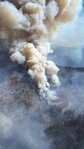
The Swiss Roll fire experienced significant growth this afternoon due to the alignment of slope and prevailing wind, combined with heavy dead and down vegetation. It is currently estimated at 170 acres. Firefighters observed group tree torching due to very dry conditions.
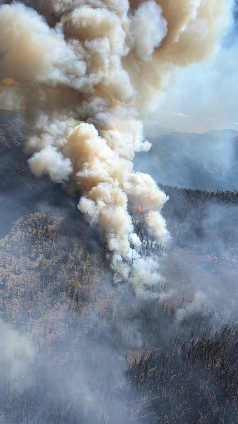
While the smoke column is very visible from the communities of Pagosa Springs, South Fork and U.S. 160, the fire itself is still very remote and not burning near values at risk. Fire crews today and tomorrow will be assessing indirect containment options to protect private inholdings and the Xcel Energy natural gas pipeline.
A map is not yet available. The State of Colorado Multi Mission Aircraft has been ordered for tomorrow for an infrared flight to get an accurate map with updated acreage.
The Pagosa Ranger District will be closing Quartz Meadow Road #684 and Quartz Creek Trail #571. Quartz Ridge trail will be closed at the Quartz Ridge trailhead near the Silver Falls guard station. The western side of the Quartz Ridge trail #570 (at the Sand Creek trailhead) will be open for approximately 4 1/2 miles until it turns east.
We will provide additional updates as new information comes available.
Update, 1 p.m., Sept. 11:
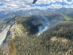
The Swiss Roll Fire has grown to approximately 25 acres as of noon on Friday. The remote, lightning-caused fire is located east of Pagosa Springs and U.S. 160, south of East Fork Road (CR 667) near Quartz Meadow. Due to a large amount of dead timber on the ground, the fire is producing a small smoke column today as it consumes these fuels, but is not growing rapidly. Smoke is visible from Pagosa Springs, U.S. 160, and the surrounding area.
The Elk Creek Wildland Fire Module is operating from East Fork Road where they can track the fire’s growth and develop computer models of it for containment efforts. They have established a weather station to track conditions and are taking regular helicopter flights to observe fire behavior. They will be prepared to engage on indirect lines if fire approaches.
Fire crews will use an indirect containment strategy for this fire, using predetermined action points for when/if the fire reaches certain locations. These fire lines may include roads and natural features (like rock outcroppings). Fire crews cannot engage the Swiss Roll Fire directly at this point due to extremely high threat to safety from falling dead trees, and lack of access in the case of a medical emergency. Additionally, the fire is not expected to threaten life or property thanks to its remote location.
Today’s increase in fire activity is due in part to hot, dry conditions, as well as a brief period of wind and slope alignment, where the fire was able to grow easily before slowing again. The Pagosa Ranger District will be implementing a partial trail closure for Quartz Ridge Trail, #570 for public safety concerns. The closure area will include Quartz Ridge Trailhead to the junction with Sand Creek. Sand Creek Trailhead and the portion of the Quartz Ridge Trail along Sand Creek will remain open approximately 4.5 miles from the Sand Creek Trailhead.
Update, 5 p.m., Sept. 8:
According to the San Juan National Forest, the Swiss Roll Fire, which was first reported on Aug. 20, has now grown to 3.5 acres. This fire is located south of East Fork Road (CR 667) near Quartz Meadow east of U.S. 160 on the Pagosa Ranger District.
The majority of the growth has been downhill due to the fire backing through beetle-killed trees that have fallen over. There is potential for increased smoke and fire activity this week given the expected dry forecast before conditions moderate this Sunday into next week.
Fire crews do not plan to engage the Swiss Roll Fire directly due to extremely high threat to safety from falling dead trees, and lack of access in the case of a medical emergency. Additionally, the fire is not expected to threaten life or property thanks to its remote location and low likelihood of significant growth.
Fire managers will continue to assess the fire daily, and will implement an indirect containment strategy with predetermined action points if fire growth reaches certain locations.
Update, 5:20 p.m., Sept. 1:
Recent rainfall has reduced fire activity on the Swiss Roll Fire, located south of East Fork Road (CR 667) near Quartz Meadow east of U.S. 160 on the Pagosa Ranger District. Fire crews do not plan to engage the Swiss Roll Fire due to extremely high threat to safety from falling dead trees, and lack of access in the case of a medical emergency. Additionally, the fire is not expected to threaten life or property thanks to its remote location and low likelihood of significant growth.
Fire managers will continue to assess the fire daily, and will implement an indirect containment strategy with predetermined action points if fire growth reaches certain locations.
Additional moisture forecasted for the end of the week is expected to keep this fire in check as it has for nearly two weeks.
Update, 5:50 p.m., Aug. 29:
Fire managers on the Pagosa Ranger District are reporting a small increase on the Swiss Roll Fire, updating the current size to 1.5 acres, with some visible smoke on the fire. The fire is located south of East Fork Road (CR 667) near Quartz Meadow east of U.S. 160.
The crew that evaluated the fire today determined that the hazards, particularly the significant number of dead standing trees, are too great to safely insert firefighters for direct engagement.
Fire managers will continue to assess the fire daily, and will implement an indirect containment strategy with predetermined action points if fire growth reaches certain locations.
The area is forecasted for continued afternoon thunderstorm buildup with chances of precipitation through Aug. 31, with an opportunity for additional moisture on the fire the end of next week. This fire has the potential to be on the landscape for several weeks, or until the fire receives substantial rain.
Update, 7 p.m., Aug. 27:
Fire managers on the Pagosa Ranger District of the San Juan National Forest reported a 0.75-acre increase on the Swiss Roll Fire today after conducting an aerial assessment, bringing the current size to 1 acre.
The growth likely resulted from recent outflow winds from area thunderstorms. Because of this expansion, a helicopter crew has been requested to further evaluate access options to contain the fire using direct line construction. The fire is smoldering in extremely dangerous, inaccessible terrain, and continues to receive daily moisture, with afternoon thunderstorms expected through this weekend.
The fire poses little risk to life or property, but poses high risk to firefighters who, if able to access, would be exposed to snags (dead trees), lightning and steep terrain with no helicopter landing zones nearby in case of emergency. Tomorrow’s flight will help determine whether the best choice is to insert crews or to assess other options.
Update, 6:20 p.m., Aug. 24:
Update, 2:15 p.m., Aug. 21:
Fire managers conducted an aerial assessment of the Swiss Roll Fire today. Located in a remote area, the fire poses minimal risk to life or property but sits in terrain that is both difficult and high-risk for ground crews to access, which could result in extended medical evacuation times in the event of a firefighter injury.
The fire received precipitation yesterday, and continued afternoon thunderstorms are predicted through at least Wednesday, making helicopter insertions especially challenging and increasing the threat of firefighters being struck by falling snags from outflow winds.
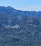
Managers will continue to assess the situation daily through aerial reconnaissance; the fire currently remains less than 1/4 acre in size, though smoke remains visible.
Update, 6 p.m., Aug. 20:
Fire crews assessed the area earlier today and have decided to postpone engaging the fire until tomorrow morning due to the steep, challenging terrain and thunderstorms currently building in the area. The fire is in a remote part of the forest and poses little risk to life or property, but crews will fly over tomorrow morning to reassess the best strategy for putting it out.
Original, Aug. 20:
Firefighters on the Pagosa Ranger District of the San Juan National Forest are responding to a newly discovered fire, named the Swiss Roll Fire, located south of East Fork Road (County Road 667) near Quartz Meadow east of U.S. 160.
Smoke is visible from East Fork Road and U.S. 160.
Fire crews are utilizing aircraft to determine best access points for reaching the area. Additional details will be provided once crews have assessed the situation.


 >