According to the U.S. Drought Monitor (USDM), as of July 18, there are no portions of Archuleta County in any drought stage for the second consecutive week.
The USDM initially reported that 100 percent of the county was not in any stage of drought on July 9.
According to USDM records, prior to July 9, the last time Archuleta County was completely drought free was on July 11, 2023, coming out of a heavy snowfall season that saw Wolf Creek Ski Area receive 490 inches of snow throughout the 2022-2023 season.
Before that, there was a four-year period during which none of Archuleta County was free of drought going back to July 16, 2019, according to the USDM.
Drought conditions reached level three and four — extreme and exceptional drought — from May 2020 to October 2020.
On May 19, 2020, USDM records show that 100 percent of Archuleta County was in a stage three or four drought.
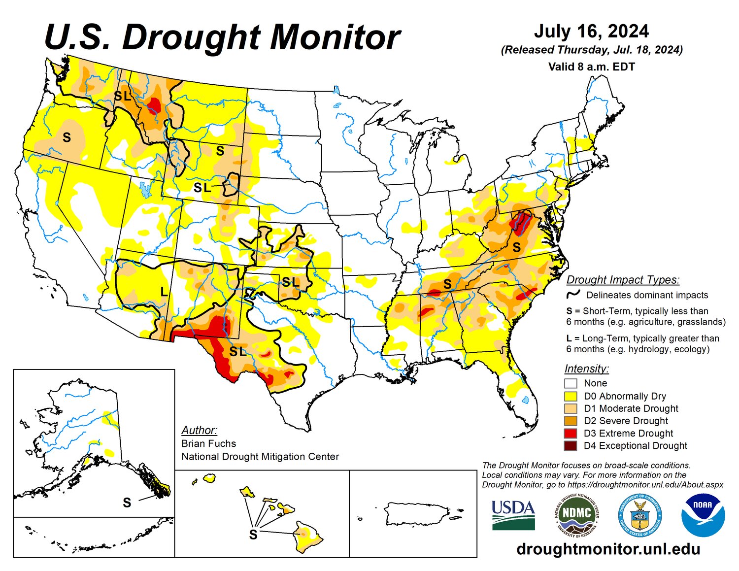
As of July 18, drought conditions remain in areas around Denver, north central and southeast Colorado, according to the USDM.
Approximately 60 percent of the state is not in any stage of drought and there are no areas in an extreme or exceptional drought stage, with less than 2 percent of the state in a severe drought stage.
Forecast
According to the National Weather Service (NWS), for Thursday, July 25,there is a 30 percent chance of showers and thunderstorms after noon, with a high forecast at 88 degrees. The low is forecast to be 52 degrees, continuing with a 30 percent chance of showers and thunderstorms.
For Friday, July 26, there is an 80 percent chance of showers and thunderstorms, with a high near 83 degrees. Chances of showers and thunderstorms will decrease to 40 percent throughout the evening with a low around 50 degrees.
For Saturday, July 27, there is a 40 percent chance of showers and thunderstorms before noon, with a high of 85 degrees. The low is forecast at 50 degrees with mostly clear skies in the evening and a slight chance of showers.
For Sunday, July 28, there is a slight chance of showers in the morning, followed by sunny skies and a high near 85 degrees. The low is forecast around 49 degrees with mostly clear skies.
According to Shawn Prochazka at Pagosa Weather, starting on Sunday, July 28, chances for thunderstorms will “drop considerably,” but isolated afternoon storms won’t totally go away.
Prochazka also notes that over the weekend bright clear skies are expected in the mornings, with clouds beginning to build over the mountains by the afternoon, producing some scattered showers.
Clouds will decrease in the evenings and “we could be treated to pretty sunsets and a rainbow,” Prochazka writes in his July 23 weather report.
River flows
According to the U.S. Geological Survey (USGS), as of 10 a.m. on July 23, the San Juan River in Pagosa Springs had a flow rate of 119 cubic feet per second (cfs).
According to the USGS, the record low for that date was in 2002 at 21.3 cfs, and the record high was in 1941 at 1,040 cfs. The average flow for that date is 156 cfs.
As of 10 am on July 23, the Piedra River near Arboles had a flow of 87.3 cfs, according to the USGS.
The record high flow for the Piedra River for that date was in 1986 at 1,170 cfs and the record low was in 2002 at 23.7 cfs, according to the USGS.


