
Winter Storm WarningURGENT - WINTER WEATHER MESSAGE
National Weather Service Grand Junction CO
116 PM MST Wed Dec 28 2022
COZ021>023-290745-
/O.CON.KGJT.WS.W.0013.000000T0000Z-221229T1200Z/
Four Corners/Upper Dolores River-Animas River Basin-
San Juan River Basin-
Including the cities of Dove Creek, Mancos, Durango, Bayfield,
Ignacio, and Pagosa Springs
116 PM MST Wed Dec 28 2022
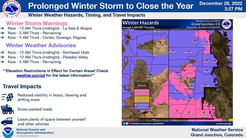
...WINTER STORM WARNING REMAINS IN EFFECT UNTIL 5 AM MST THURSDAY
ABOVE 6500 FEET...
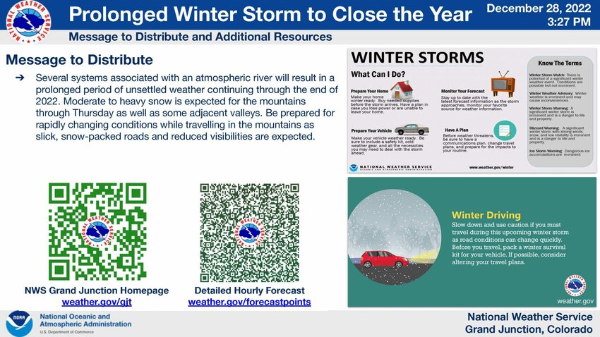
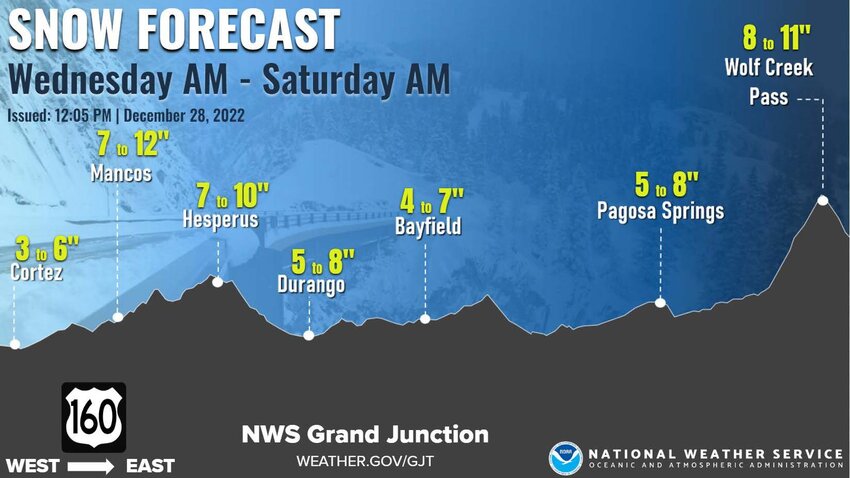
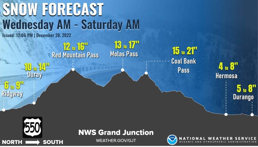
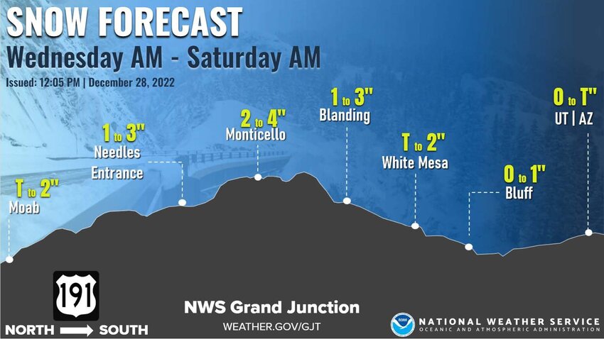
* WHAT...Heavy snow above 6500 feet. Additional snow accumulations
of 2 to 4 inches, bringing total snow accumulations to 5 to 10
inches with locally higher amounts.
* WHERE...Four Corners/Upper Dolores River, Animas River Basin
and San Juan River Basin.
* WHEN...Until 5 AM MST Thursday.
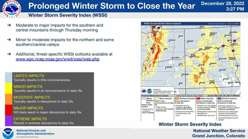
* IMPACTS...Plan on slippery road conditions. The hazardous
conditions could impact the evening commute. A detailed map of
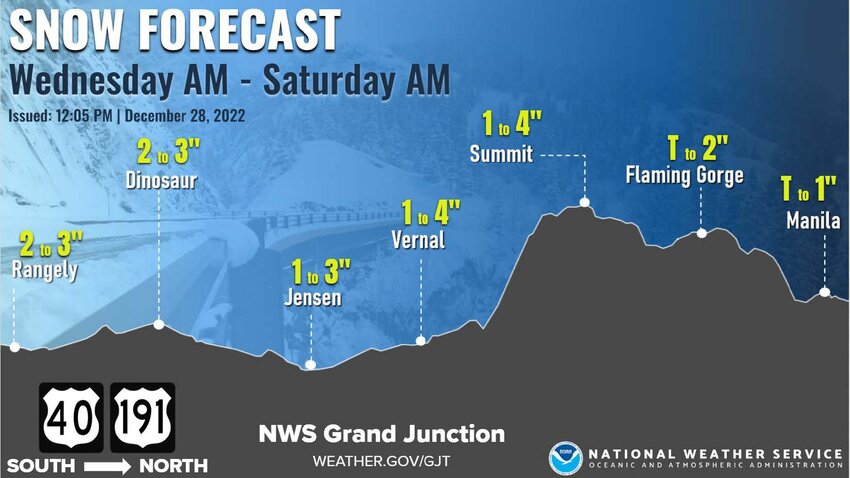
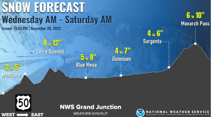
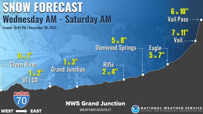
the snowfall can be found at: www.weather.gov/gjt/winter.
PRECAUTIONARY/PREPAREDNESS ACTIONS...
If you must travel, keep an extra flashlight, food, and water in
your vehicle in case of an emergency.
The latest road conditions for the state you are calling from can
be obtained by calling 5 1 1.


