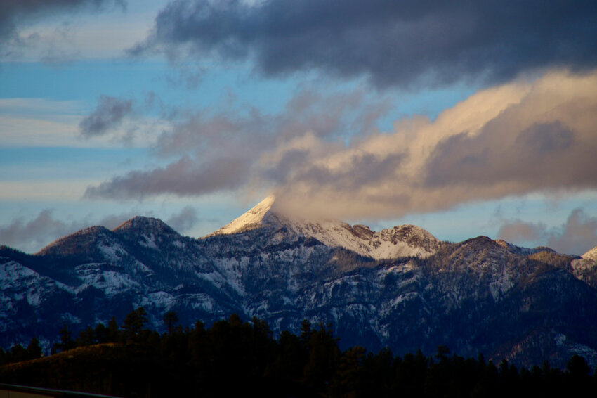
Pagosa Peak peeks out from behind the clouds on Friday afternoon. On Wednesday morning, Wolf Creek Ski Area reported a season-to-date snowfall total of 71 inches.
By Josh Pike | Staff Writer
Additional snowfall has come to the San Juan Mountains, although mostly clear conditions are expected for the rest of the week.
An 8 a.m. Dec. 7 report from Wolf Creek Ski Area indicated that Wolf Creek had received 7 inches overnight and 11 inches in the previous 48 hours, bringing the midway base depth to 39 inches and the season-to-date snowfall total to 71 inches.
According to the U.S. Department of Agriculture (USDA) National Water and Climate Center’s snowpack report, the Wolf Creek summit, at 11,000 feet of elevation, had 8.3 inches of snow water equivalent as of 1 p.m. on Wednesday, Dec. 7.
The Wolf Creek summit was at 99 percent of the Dec. 7 snowpack median.
The San Miguel, Dolores, Animas and San Juan river basins were at 88 percent of the Dec. 7 median in terms of snowpack.
According to the Community Collaborative Rain Hail and Snow Network (CoCoRaHS) website, as of Wednesday morning, sites in Archuleta County received between 0.2 and 1.8 inches of snowfall over the previous 24 hours.
Higher snowfall totals were concentrated in the central and northern portions of the county, with the highest reported snowfall amount located near Lake Hatcher north of Pagosa Springs.
Avalanches
According to the Colorado Avalanche Information Center (CAIC) website, the southern San Juan range, including Wolf Creek Pass, was at level four — high — in terms of avalanche danger as of noon on Dec. 7.
The CAIC uses a scale of one through five to assess avalanche danger in regions around the state.
An avalanche warning is also in effect, beginning at 4:30 p.m. on Dec. 6 and ending at 7 a.m. on Dec. 8.
The CAIC website notes on the warning, “An Avalanche Warning is in effect for the areas surrounding Wolf Creek, Cumbres, and La Manga Passes. Heavy snowfall and wind have created dangerous avalanche conditions. Some avalanches will release naturally and can be triggered from a distance or below. Avalanches will break larger and run further than you expect. Avoid travel in or under avalanche terrain.”
The CAIC forecast discussion also references the recent storm, stating, “A potent winter storm arrives Tuesday night in the Southern Mountains, and snow continues into Wednesday night. The area surrounding Wolf Creek Pass looks to be the biggest winner, but the Southwest corner of our zone, including areas from Lizard Head Pass to the La Plata Mountains to Vallecito, will be receiving healthy amounts of snow as well. Though totals are less from Telluride to Ouray to Silverton, expect the avalanche danger to be on the rise across the board Wednesday, no matter where you are traveling in the Southern Mountains. This is the first major storm to challenge our very weak early-season snowpack. Regardless of where you are, you can expect conditions to be spicier than what you’ve seen recently and danger to be increasing during the day Wednesday as the storm continues.”
The forecast discussion also touches on safe travel measures, indicating, “Expect avalanches to break larger and travel farther distances than we have seen this season. Remote triggering and triggering from below will become increasingly likely as we put a thick slab on top of our fragile weak layer. Make sure to give yourself wide margins from steep slopes above you. Very conservative trip planning and careful terrain management will be essential if you choose to venture out today in much of the southern mountains. Give the snowpack a day or two to adjust is the safest bet in locations under an Avalanche Warning, such as the La Plata Mountains and Wolf Creek Pass.”
Additional avalanche information can be found online at https://avalanche.state.co.us
Weather
The National Weather Service (NWS) forecasts that mostly sunny skies will return to the region on Thursday, Dec. 8, with a high of 28 and 5 mph winds.
Thursday night is predicted to bring mostly clear skies with a low of 11 and 5 mph winds.
For Friday, Dec. 9, the forecasted high is 29 degrees with partly sunny skies and 5-10 mph winds. The forecasted low is 11 degrees with mostly clear skies.
For Saturday, Dec. 10, mostly sunny skies are expected with a high of 31 degrees. The forecasted low is 16 degrees Saturday night with mostly clear skies.
For Sunday, Dec. 10, the forecasted high is 32 degrees with partly sunny skies and a chance of snow showers, mainly after 11 a.m. The forecasted low is 21 degrees with mostly cloudy skies and a chance of snow showers.
River report
Stream flow for the San Juan River on Dec. 7 at approximately 1 p.m. was 84.5 cubic feet per second (cfs), according to the U.S. Geological Service (USGS) National Water Dashboard.
This reading is up from last week’s reading of 59.2 cfs at 1 p.m. on Nov. 30.
josh@pagosasun.com


