By Josh Pike | Staff Writer
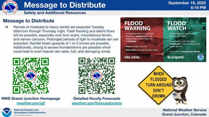
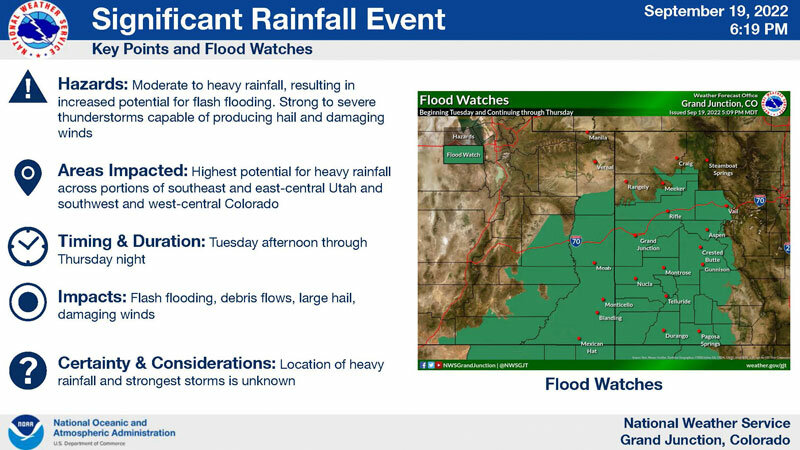
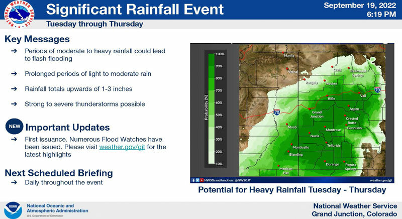
Heavy rains are forecast for Pagosa Country between Tuesday, Sept. 20, and Thursday, Sept. 22, and a flood watch is in effect between those dates.
The National Weather Service (NWS) forecasts that Pagosa Springs will experience isolated showers before 9 a.m. on Tuesday Sept. 20, scattered showers between 9 a.m. and 4 p.m. then showers and thunderstorms are likely after 4 p.m. Overall, the forecast indicates that Tuesday will see partly sunny skies with a high of 68 and 5-10 mph winds. It also states that some storms may cause heavy rain.
On Tuesday night, showers and possible thunderstorms are expected with a potential for heavy rains. The low is forecasted to 53 with 5 mph winds before midnight.
On Wednesday, Sept. 21, showers and possible thunderstorms are expected with heavy rains possible. A high of 62 is forecasted with 5-10 mph winds in the morning.
Wednesday night will bring showers and possible thunderstorms, which could include heavy rains, and a low of 50.
Thursday, Sept. 22 is forecasted to have showers and possible thunderstorms with a potential for heavy rains and a high of 57.
The forecast for Thursday night indicates that showers and possible thunderstorms are likely before midnight with a chance of showers afterwards. The forecast notes that some storms could produce heavy rain and that the low is predicted to be 47.
The NWS flood watch is scheduled to be in effect for much of southwestern Colorado and Utah from Tuesday afternoon to Thursday evening, with the possibility of heavy rains causing flash floods in the region.
The flood watch indicates that these rains could cause flooding of rivers, streams and low lying areas and that residents and visitors should monitor forecasts and prepare to take action if flash flood warnings are issued in their area.